August 12, 2020Updated flood zone maps for Charleston County will take effect in January 20211. The maps are based on more accurate…
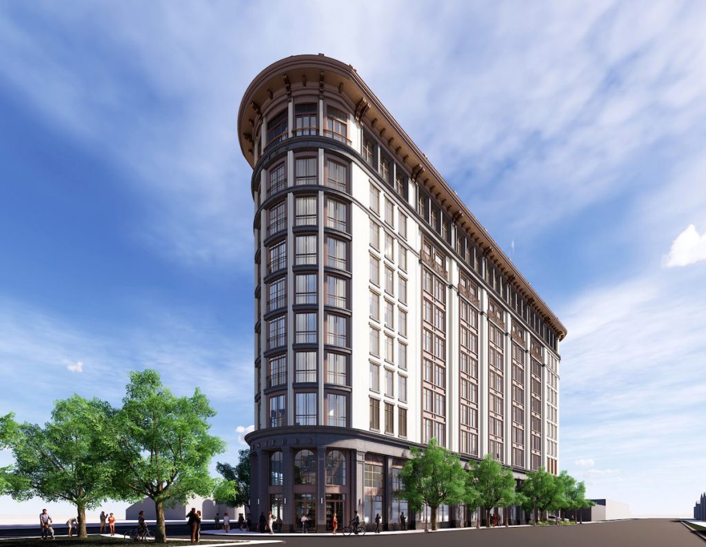
 October 23, 2019The proposed Montford Building will feature ground floor amenities, a rooftop restaurant and pool lounge, and 191 rooms, contributing to…
 February 22, 2018Charleston combats tidal flooding by installing check valves in stormwater drains, effectively reducing street flooding during high tides. Early results…
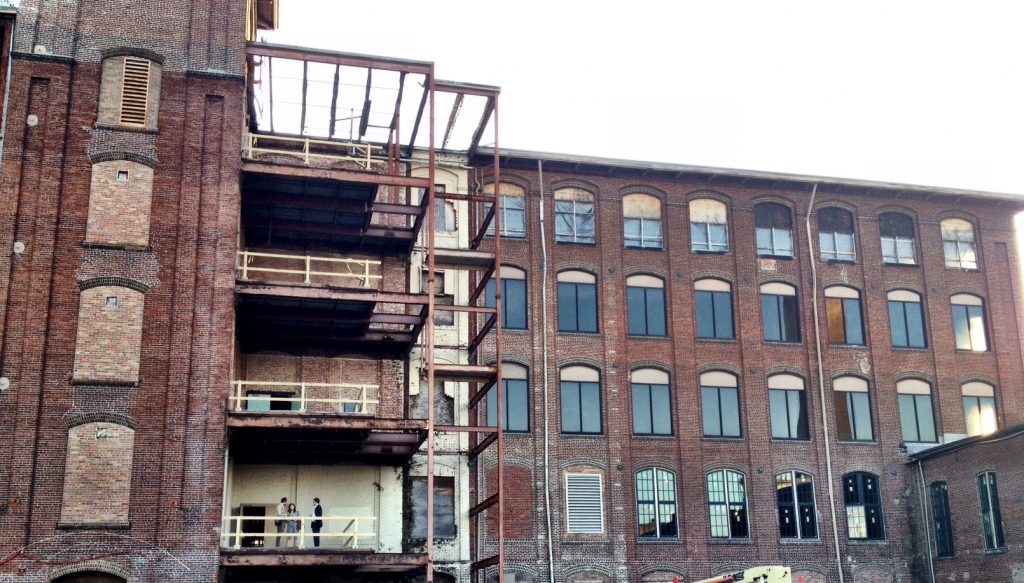
 May 12, 2014The Cigar Factory has been intertwined in the history of Charleston as a functioning symbol of national economic recovery -…
 November 10, 2013A transformative project through the center of the peninsula of Downtown Charleston is in the works – a linear park…