Notes from Bryan
Sandlapper Journal
A collection of observations on Charleston, real estate, history, planning, technology, and other subjects that pique my interests.
sand•lap•per
noun
An early regional name for a South Carolinian, especially one from the state’s sandhills and coastal regions.
 April 11, 2020
Invasive Plants – A Charleston Field Guide
A homeowner’s guide to invasive plants in the Charleston Lowcountry. Learn to identify common invasive vines, trees, grasses, and aquatic plants before they become costly problems.- February 24, 2015
The Charleston Single House
The Charleston Single House, unique to Charleston, SC, features a narrow, side-facing layout influenced by Caribbean architecture. Key design elements include side piazzas and central hallways. This style maximizes lot use, improves ventilation, and offers fire… - January 13, 2025
2024 Charleston Real Estate Market Report
The 2024 Charleston Real Estate Market Report with local analysis of home prices, inventory, sales trends, and what the year’s shifting market meant for buyers and sellers.  November 22, 2023
Stamps and Coins
The postage stamps, ranging from the Charleston Sesquicentennial in 1930 to the Poinsettia Day stamp in 2013, vividly depict significant events, landmarks, and cultural elements that define South Carolina.- June 23, 2023
Homes on The Battery
Explore homes on the Battery in Charleston – including historic residences along East Battery Street, Murray Boulevard, and South Battery Street. Learn the difference between the High Battery and Low Battery, view current listings and recent… - June 8, 2022
Bridges of Charleston County
Charleston's bridges do more than move traffic from one peninsula or island to another – they shape commuting patterns, development pressure, evacuation routes, waterfront access, and the daily rhythm of life across the Lowcountry. - March 25, 2022
West Ashley Greenway
The West Ashley Greenway accommodates walkers, joggers, cyclists, and naturalists through more than ten miles of linear park, connecting a number of neighborhoods and business centers. Its path parallels that of Savannah Highway.  September 1, 2021
Liberty Center
A proposed a plan to revamp the street level at 151 Meeting Street by activating its covered walkway flanked by stone pillars, which is already continuous with the city sidewalk beyond it. June 8, 2021
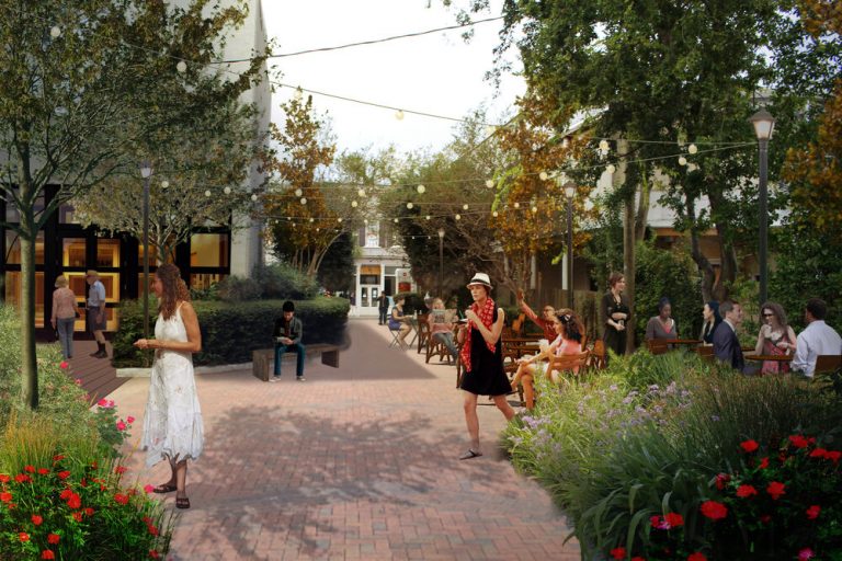
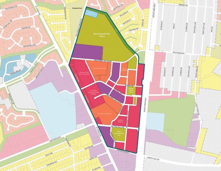
A Walkable Goose Creek
- January 28, 2021
Astronaut Ron McNair
McNair's story is a testament to the transformative power of education, a beacon of hope for young minds across South Carolina, and a constant reminder that even in the face of adversity, the sky is not…  August 12, 2020
New Flood Zone Maps
Updated flood zone maps for Charleston County will take effect in January 20211. The maps are based on more accurate data and methods that reflect the flood risks from storm surge, rainfall, and tidal forces2. The…


Recurring themes
Some topics come up more than others.
Charleston, real estate, history, planning, technology, and other recurring interests.
Browse topics