June 23, 2023Explore homes on the Battery in Charleston – including historic residences along East Battery Street, Murray Boulevard, and South Battery…
 August 12, 2020Updated flood zone maps for Charleston County will take effect in January 20211. The maps are based on more accurate…
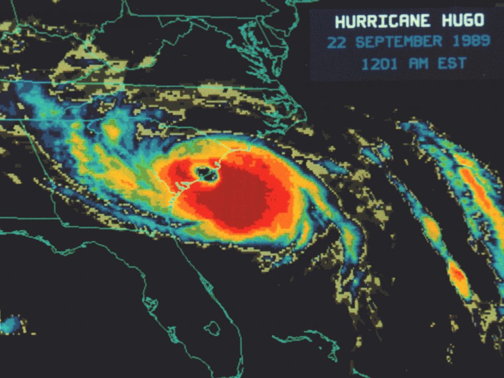
- September 18, 2019Charleston became stronger after Hurricane Hugo in 1989 by improving its building codes, ecosystems, infrastructure, emergency preparedness, and economic diversity.…
 February 22, 2018Charleston combats tidal flooding by installing check valves in stormwater drains, effectively reducing street flooding during high tides. Early results…
 April 13, 2016Incorporating a green roof into the design of a building expands the usefulness of that space.
- November 10, 2013A transformative project through the center of the peninsula of Downtown Charleston is in the works – a linear park…