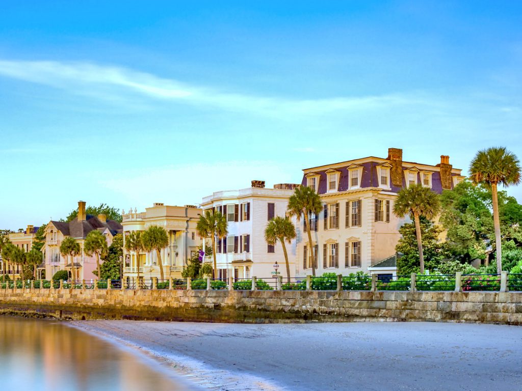
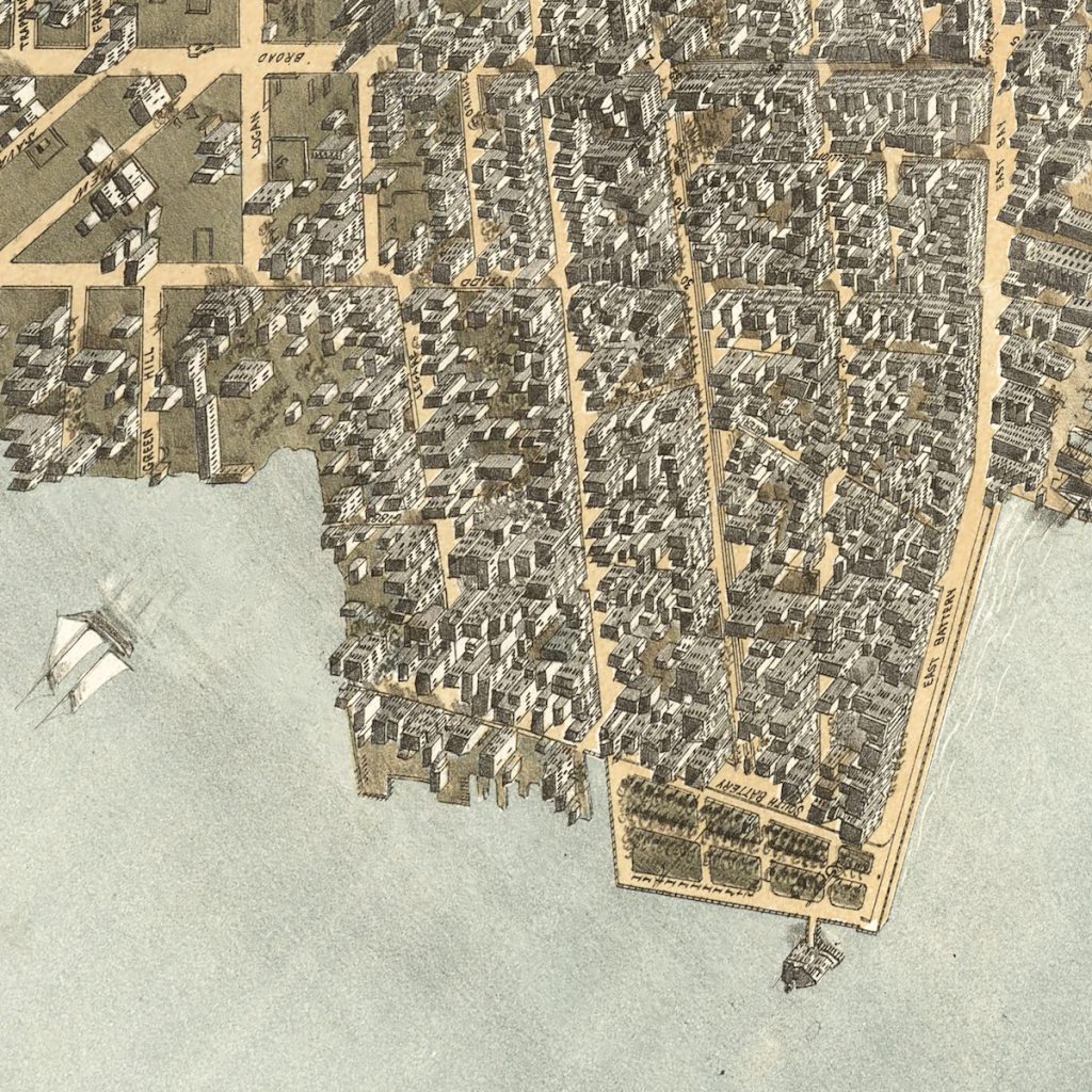
Homes on The Battery
The Battery not only demarcates Charleston’s southern boundary but also offers sweeping views that showcase its historical and cultural prominence within the Lowcountry.
The homes on The Battery reflect layers of architectural history, beginning with the early residences that extended southward from East Bay Street.
Behind the Revolutionary War-era fortifications of the High Battery, this area evolved into East Battery Street, where 18th- and 19th-century estates now stand as Charleston’s architectural gems.
During this era, White Point Garden began to take shape, and the construction of the Low Battery set the stage for the notable homes along today’s Murray Boulevard.
This walkway along the southern edge of the Historic Charleston peninsula provides a distinctive vantage point to appreciate the depth of the city’s heritage.

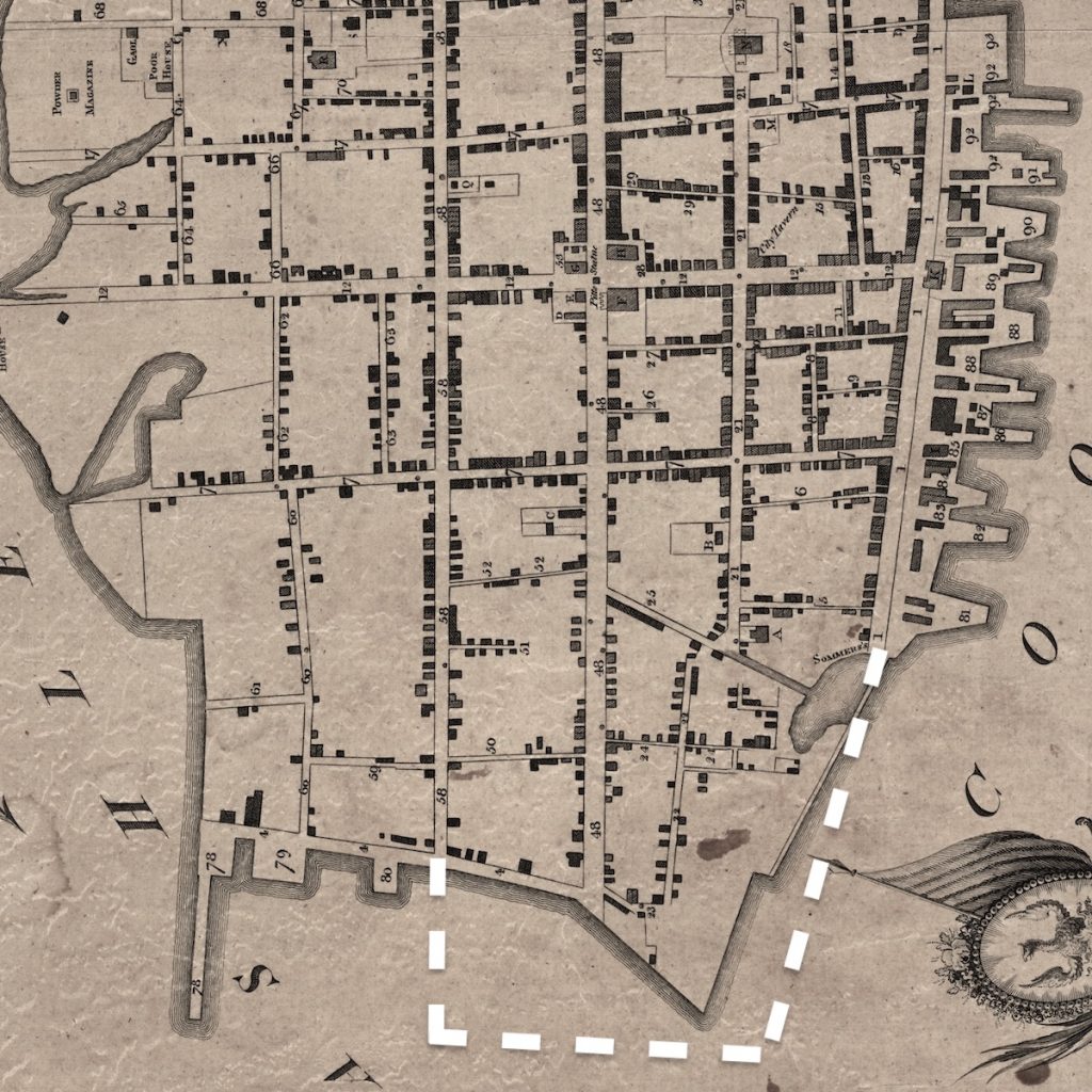
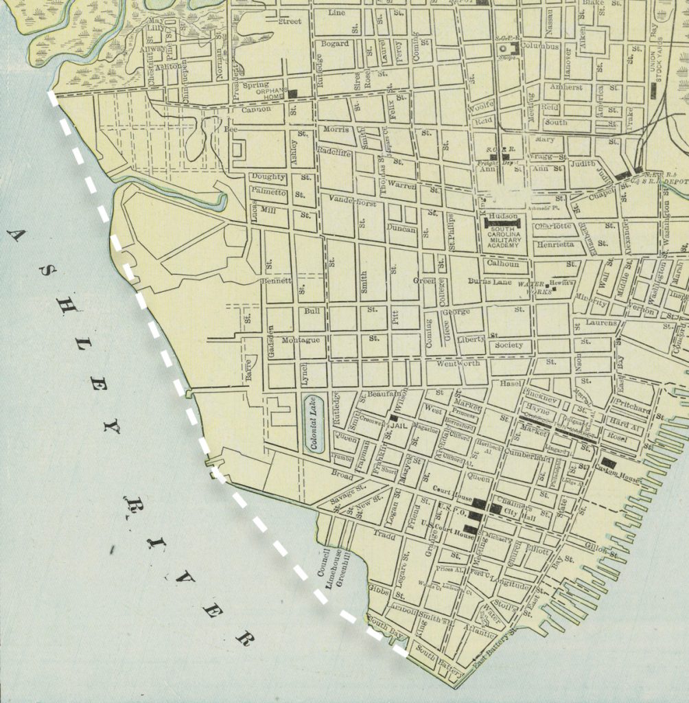
What’s commonly grouped together as “the Battery” is better understood in three segments. The approach along East Bay gives way to the High Battery on East Battery Street, where grand facades face the harbor; beyond that, White Point Garden anchors the peninsula’s tip before the line continues toward Murray Boulevard. Same promenade, different perspectives.
The High Battery
The High Battery runs along East Battery Street, elevated above the seawall and offering the most iconic views of Charleston Harbor. Homes here sit elevated above the seawall, offering both physical separation from the tide and uninterrupted harbor views.
Architecturally, this stretch is dominated by large historic single houses and grand double piazzas designed to capture prevailing breezes. These are among Charleston’s most recognized addresses, with uninterrupted harbor views and direct access to the promenade.
Current Listings & Recent Sales
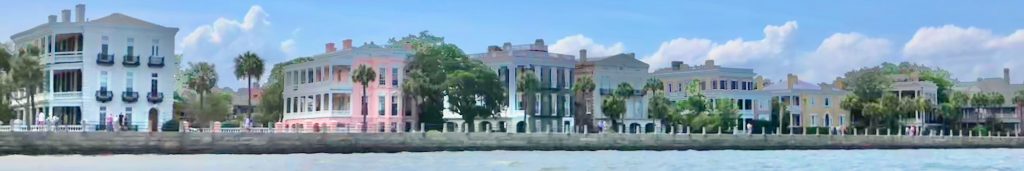
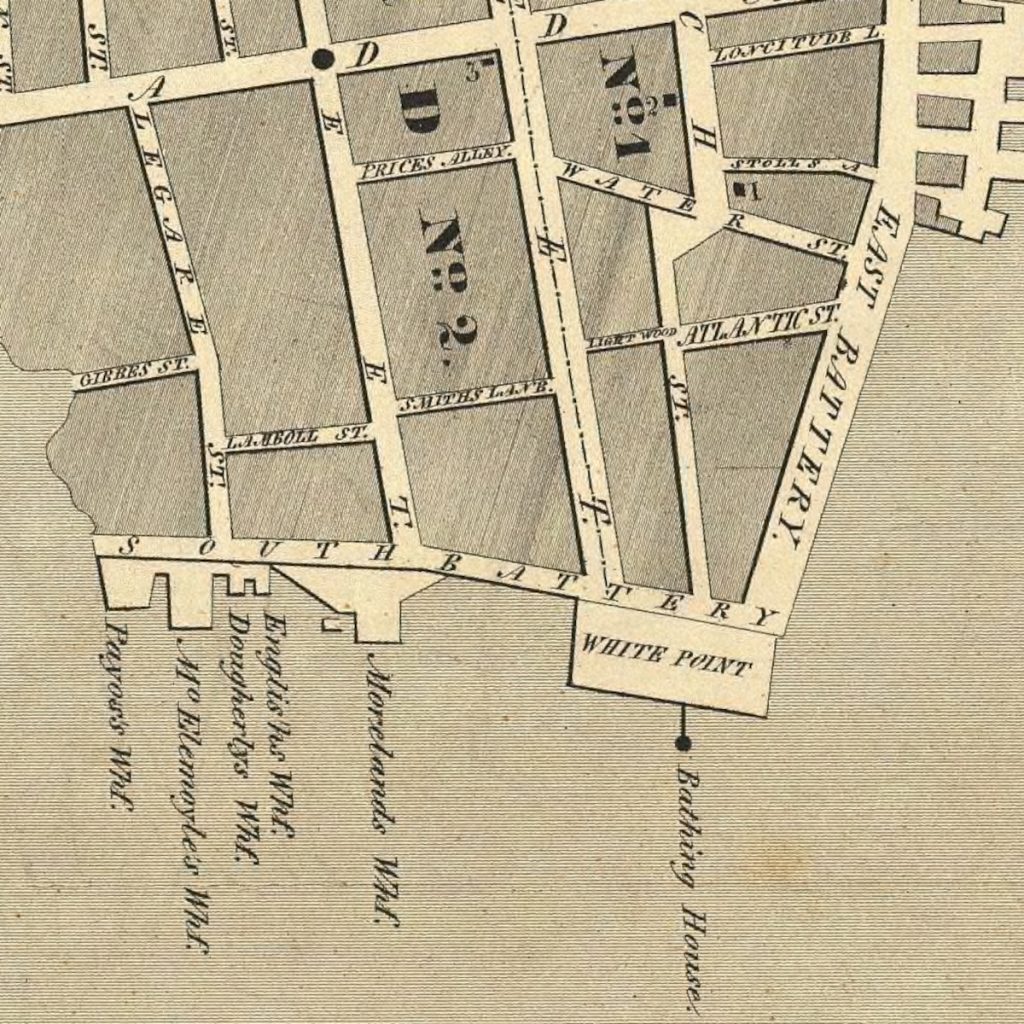
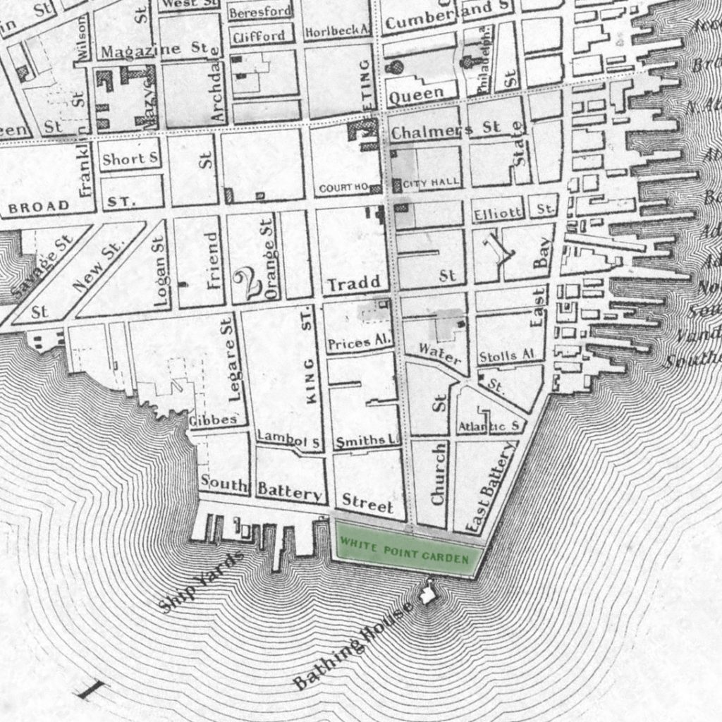
White Point Garden
The stately homes facing the north side of White Point Garden showcase a harmonious blend of Federal, Greek Revival, and Victorian architectural styles accented by lush gardens and ornate wrought-iron details. Overlooking the high oaks of the six-acre park from across South Battery Street, these residences offer a picturesque setting that combines the tranquility of White Point Garden with sweeping views of Charleston Harbor.
Current Listings & Recent Sales
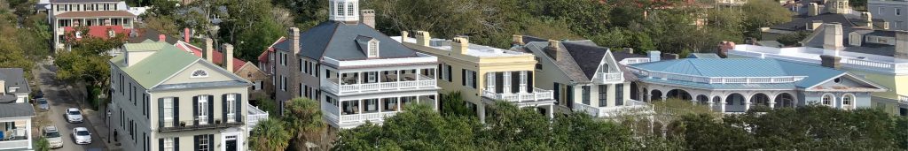
The Low Battery

The homes along the Low Battery on Murray Boulevard reflect Charleston’s architectural evolution into the early 20th century, featuring styles such as Colonial Revival, Craftsman, and Neoclassical, every one with panoramic views of Charleston Harbor. These residences are more contemporary than their High Battery counterparts, yet they maintain the grandeur and elegance characteristic of South of Broad homes.
Current Listings & Recent Sales
History of The Battery
Colonial Defense
From its founding in 1680, the provincial city of Charles Town established mostly on the high grounds of what is now the French Quarter and South of Broad, southward to the banks of Vanderhorst’s Creek (modern day Water Street).
Beyond this creek was a sandy shoreline known as White Point, for its expanses of oyster shells deposited among the tide-lashed beach.
In the 1720s, the provincial government of South Carolina sought to establish a barricade on the southern end of the peninsula, beginning with the installation of simple wooden pilings flanked by ballast stones.

By the next decade, Charles Town made its first expansion into the harbor, extending Church Street over Vanderhorst’s Creek, terminating with a new brick fortification known as Broughton’s Battery.
A double row of wood pilings in the sandy beaches of White Point extended westward to Council Street, and the first iteration of a southern seawall in Charleston began to take shape and define the southern boundary of the provincial town.
As a European war broke out in the 1740s and spilled over to the colonies, the Charleston battery was fortified with earthen ramparts around White Point and several cannons on Broughton’s Battery. The pilings and bulwarks remained a few years after the end of what the colonists termed King George’s War, but were largely destroyed by a powerful hurricane in September of 1752.
Seeking a more permanent seawall to fortify the southern peninsula and protect from attack, a far more substantial system of ramparts were built in the 1750s. These earthen walls were still susceptible to the forces of nature, and by the late 1760s a brick wall was constructed to protect them, five feet high and backfilled – permanently raising the beach of White Point. Banks of cannons were installed to protect the city, and by 1769 the brick wall a half mile in length rose above what was once the beaches of White Point.
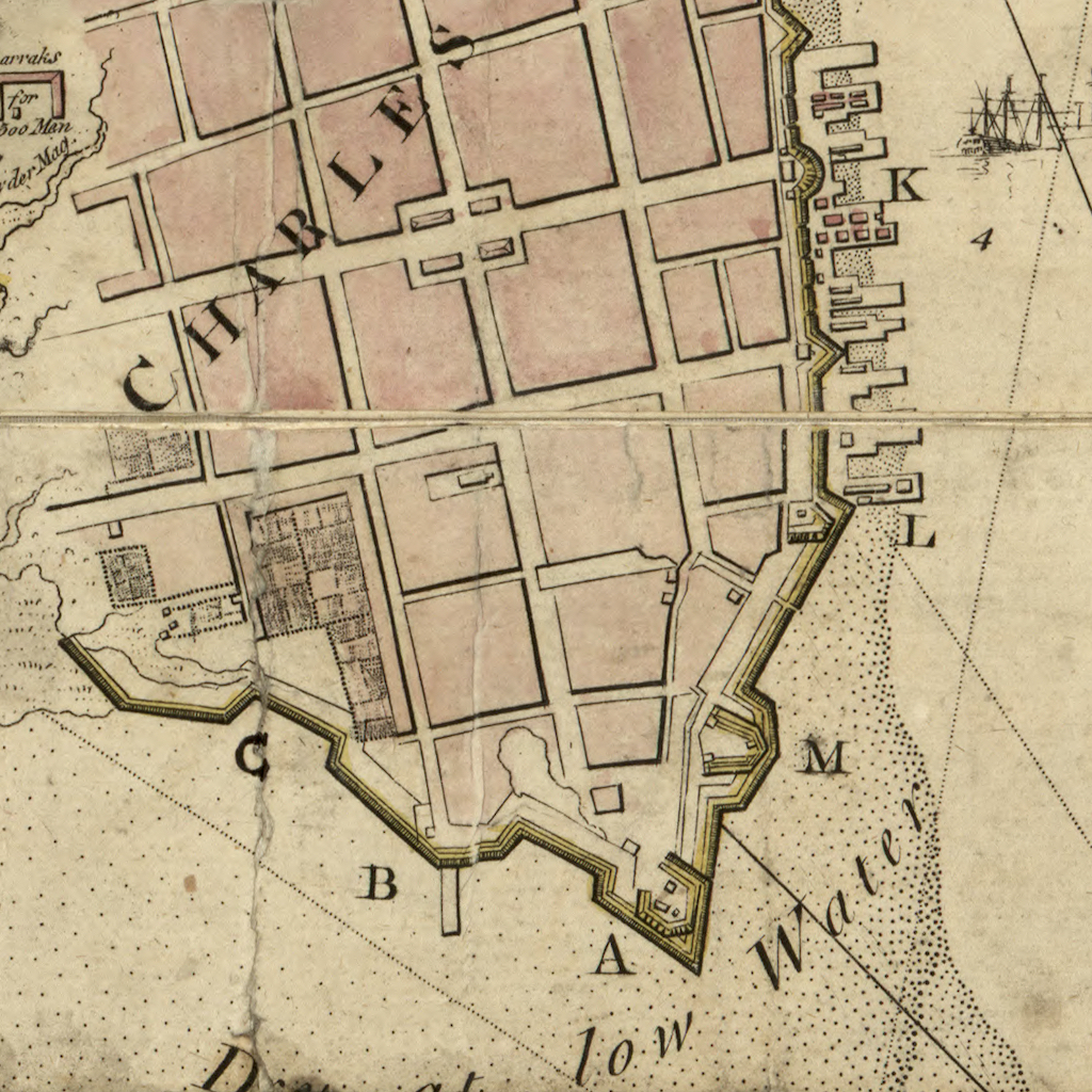
By this time tensions were rapidly accelerating between the colonies and Great Britain, and by the time the Revolutionary War kicked off in 1776 the battery in Charleston was thoroughly militarized with defensive cannons behind parapet walls.
The High Battery
It was the dawn of a new era in the 1780s for the freshly established United States. Following three unpleasant years of British occupation, the City of Charleston was liberated and incorporated in 1783.
Wartime fortifications on White Point were mostly dismantled, along with the half-century old ramparts and pilings.
The City of Charleston embarked upon an ambitious plan to expand the area around White Point for southward development of the city: a sixty-foot-wide promenade enclosed by a robust new seawall. A complicating factor: the seawall must be constructed entirely within the waters of the Cooper River.
Fortunes were not on the side of the construction efforts that commenced in the 1790s, as the hurricane of 1797 destroyed the entire project. After starting again the next year, the hurricane of 1800 came along to again destroy the project. A revamped plan to employ brick walls instead of palmetto logs commenced the following year, but even this was totally destroyed by the hurricane of 1804.
The plan for The Battery was again overhauled, this time with more durable materials: granite blocks. Following a decade of construction – even during the War of 1812 – the High Battery much as we know it today was complete by 1818, enclosing acres of new vacant land in the South of Broad neighborhood from the Cooper River.
The wide promenade became an extension of East Bay Street, and would come to be known as East Battery Street. Throughout the first half of the 19th century, grand homes were constructed on East Battery Street in lavish opulence.
The Battery remained much the same until the hurricane of 1854, after which the seawall was raised to its current height.
This structure, which we call The High Battery, remains in place today.
The High Battery – over the years


White Point Garden
By the 1830s Charleston decided the best use for much of the new land behind The Battery would be a grand public park, the city’s first.
A wharf wall of palmetto logs built up the southern end of the peninsula from the High Battery to Meeting Street, and additional earth was brought in for backfill along with plantings to create a green space about half the size of the current park.
By 1852 Charleston had enclosed White Point Garden with a seawall of more durable granite materials that composed the High Battery constructed years earlier, and nearly doubled its size with an extension to King Street.
While much of the newly created land behind the High Battery remained vacant, by 1860 a number of homes were built adjacent to White Point Garden during this era, along South Battery Street.
White Point Garden – over the years


The Low Battery
As repairs and improvements to the High Battery were completed in the 1850s, leaders in the City of Charleston devised ambitious plans to extend White Point Garden to the west, protected by a new seawall in the Ashley River.
The current occupants of that land were a number of wharves and shipyards that were generally frowned upon as unbecoming of such an otherwise beautiful promenade. The city made moves to purchase this land, and was initially successful with some parcels – including the site that is today the Fort Sumter House.
Despite best laid plans, several legal snafus and then a devastating Civil War ground this process to a halt for decades.
Needless to say, Charleston experienced a half century of economic ravages and shifting priorities for its infrastructure. However by the 1900s city leaders began to revisit the idea of extending The Battery westward into the Ashley River.
The idea for The Boulevard Project was bold: a new seawall extending from White Point Garden into the Ashley River to Tradd Street, and then extending up the Ashley River all the way to a proposed bridge at Spring Street in Midtown.
The project was to be completed in stages, with the ambition of eventually reaching as far north as Hampton Park.
The transformation of the Ashley Riverfront would be dramatic.
The Low Battery is named such as its height was built lower than the original East Battery, which buffers the brunt of tropical storms.
The first phase of the Boulevard Project extended from White Point Garden to Tradd Street.
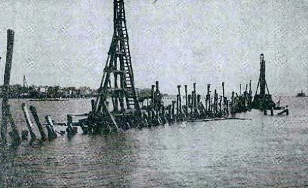
The city broke ground in 1909 on a new seawall nearly 4,000 feet in length that would be backfilled to create an entirely new waterfront neighborhood in South of Broad.
Ultimately this first phase was the only phase, and our Low Battery terminates at the U.S. Coast Guard Base Charleston on Tradd Street.
The Low Battery seawall was completed in 1911, and once dredging from Charleston Harbor produced 667,000 cubic yards of fill behind the seawall, there was a whopping 47 acres of new buildable land, much of it waterfront. Once parceled, the South of Broad neighborhood gained 191 new residential lots.
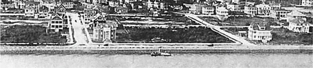
Atop the seawall was a promenade paved in oyster shells, as were several of the new streets.
The oyster shell surface quickly disappeared into the newly filled mudflats, until a local resident – Andrew Buist Murray – donated funds to have the street properly paved.
The waterfront street along the Low Battery has since been named Murray Boulevard, and wraps around White Point Garden to join East Battery Street.
The Battery in Today's Charleston

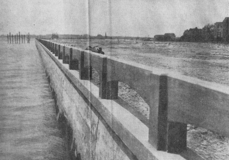
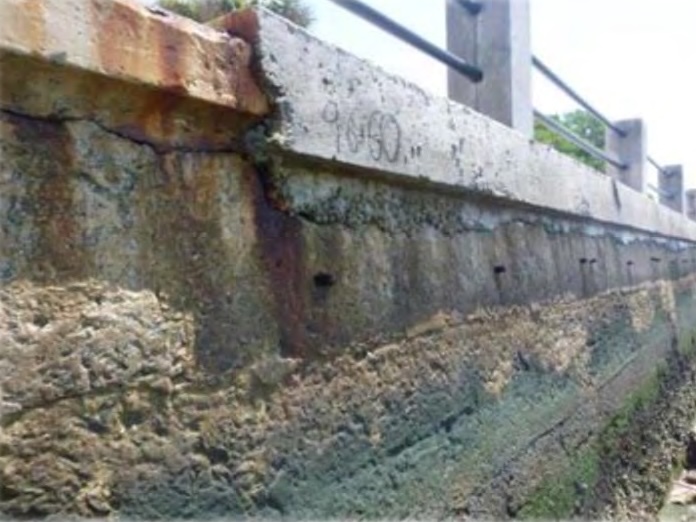
The Battery’s historic seawalls have quietly become a modern resilience project. After more than a century of tides and storms, the Low Battery seawall was showing its age – even as a young sandlapper I remember it as infrastructure that had clearly run its course.
The concrete was cracked and crumbling around the rusted out pilings, and gave the sense that even century-old monolithic infrastructure has its limits. A patchwork of interim fixes over the decades was itself succumbing to relentless saltwater and increasingly intense tropical storms – forces that are well beyond the design intent of 1910s-era engineering.
When the City began rebuilding the wall in 2019 and proposed raising the Low Battery by roughly two feet, it was not universally applauded. Some residents of Murray Boulevard understandably objected that their first-floor harbor views would become partially or fully obstructed. At the same time, many of those same homes have endured repeated saltwater inundation – foundations compromised, ductwork ruined, and yards that needed to be completely replanted.
These tropical episodes had long been an infrequent but acceptable cost of waterfront ownership, but have in the past two decades become more of a trending pattern. The “Low” Battery now stands nearly level with the High Battery – a physical manifestation of defending an historic American city from the direct effects of a changing climate.

The reconstruction also reshaped Charleston’s stormwater strategy in a way that is almost deceptively obvious. Much of the peninsula’s runoff is funneled toward the harbor where it shoots out of discharge pipes protruding from the seawall, but the originals simply did not have the capacity to handle the stormwater load of a summer storm. The drainage system installed in the new seawall dramatically increases that capacity, and adds check valves to prevent high tides from pushing water back into the city – a phenomenon we often call “sunny day flooding.”
Above it all, the decaying walkways were fully rebuilt, and the more substantial seawall now accommodates modern widths and full ADA compliance. Parking was reconfigured as well – reduced in number due to the added elevation – but the City ultimately retained free public access rather than converting the area to residential permit-only parking. The postcard view remains; it has simply been engineered with a clearer understanding of what the next fifty years are likely to bring.