The Lowcountry Lowline
Charleston’s long-planned Lowcountry Lowline is finally moving from civic aspiration into physical construction.
The first phase runs from Mount Pleasant Street to Line Street, with completion currently estimated for June 2027. The finished corridor is intended to work as daily infrastructure in the urban core of Charleston.

- Phase 1: Mount Pleasant Street to Line Street
- Status: construction underway
- Current estimate: completion in June 2027
- Larger concept: continued connection south toward Marion Square
The Lowline Today
The corridor follows an old railroad route through the Charleston peninsula, much of it beneath or alongside I-26. The current phase is expected to include separate pedestrian and bicycle paths, neighborhood connections, improved crossings, lighting, seating, bicycle parking, public amenities, and an initial park space.
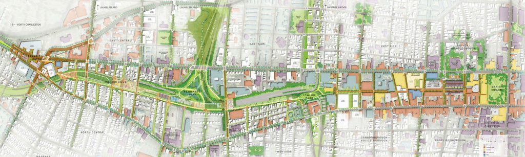
That is not the entire Lowline imagined in the 2020 conceptual master plan. The larger plan extends south toward Marion Square and describes a broader system of parks, paths, alleys, ecological landscapes, stormwater features, and connections into surrounding streets.
The northern portion has room to behave more like a conventional greenway. The southern portion must pass through a tighter city fabric of sidewalks, crossings, alleys, and private property. The current construction phase is therefore best understood as the first credible test of the concept, not the completion of everything shown in the original renderings.
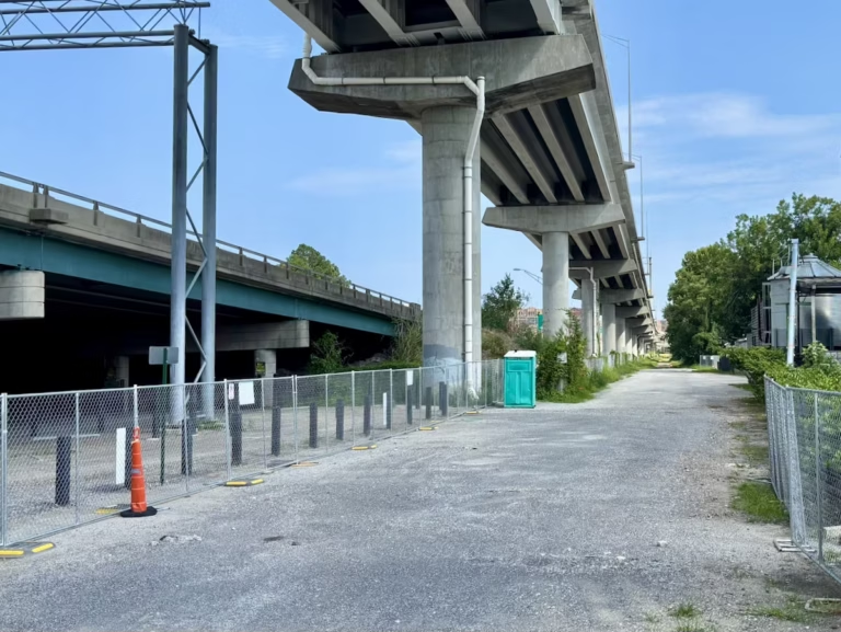
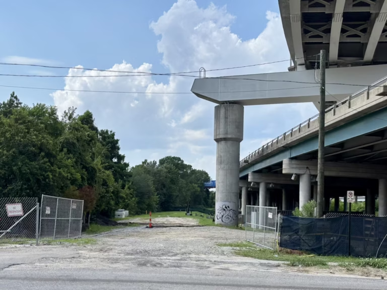
Project scope, final amenities, materials, and scheduling may continue to change as design and construction proceed.
Homes near the Lowline
A home may sit only a few hundred feet from the corridor but require crossing a difficult intersection to reach it. Another property farther away may have a direct and comfortable route to an entrance.
That is why the Lowline should not be treated as one uniform real estate feature. Its major sections create different location stories, and the listings below should be read with that geography in mind.


The point of showing homes by section is not to imply that one part of the Lowline is universally better. It is to make the geography legible. A portal can tell you that a house has three bedrooms and sits 0.3 miles from the project. It cannot tell you whether those 0.3 miles involve a quiet sidewalk, a highway ramp, an unbuilt future phase, or a surprisingly determined puddle.
Why it Matters
The Lowline could provide a safer north-south route through an area where rail lines, highway infrastructure, dead-end streets, and redevelopment have made local movement unnecessarily difficult.
Its value comes from several jobs working together: reconnecting streets, creating usable public space from leftover land, improving access among North Central, the Westside, Upper Morrison, and the downtown edge, and making room for stormwater treatment and planting in a part of Charleston where drainage is not a decorative concern.
The project will also influence development. Done well, new buildings can provide active edges, useful entrances, and better connections between private development and public space. Done poorly, the Lowline becomes attractive scenery for projects that borrow its identity while contributing little to the public realm.
A project intended to reconnect neighborhoods should not be judged only by how successfully it raises the marketing value of being “steps from the Lowline.”
The best version of the project is not merely a trail or park. It is public infrastructure that makes nearby neighborhoods easier to move through and more pleasant to inhabit.
The Plan
That southern extension is more complicated because the route becomes dependent on sidewalks, alleys, street crossings, easements, and coordination with adjoining development rather than one continuous strip of public land.
Under construction now
- Mount Pleasant Street to Line Street
- Approximately 1.6 miles
- Paths, crossings, lighting, amenities, and an initial park
- Funded construction with a current completion estimate
Larger conceptual plan
- Continued connection toward Marion Square
- Nearly two miles overall
- Additional public spaces, alleys, ecological features, and connections
- Later work without one overall completion date

North Central Corridor
The northern section has the greatest amount of open land beneath and around the elevated highway.

The Parks
The middle section carries the widest public-space and stormwater ambitions.

Urban Core
The southern section is tighter and more dependent on surrounding streets, alleys, and development.
The original master plan also includes wetlands, runoff treatment, floodable park areas, planting strategies, event spaces, markets, and a variety of recreational uses. Those ideas are useful for understanding the project’s ambition, but they should not all be read as funded promises for the phase now under construction.
From here, the project should be judged by four practical tests:
Access and crossings
Safe, visible crossings and useful entrances from adjoining neighborhoods.
Walking and bicycling
A legible separation between pedestrian and bicycle movement.
Comfort and drainage
Shade, lighting, visibility, and stormwater systems that work in actual Charleston weather.
Maintenance and edges
Long-term care and public edges that connect to – not turn away from – the neighborhoods beside them.
Railroad to Freeway
In 1827, the South Carolina legislature chartered the South Carolina Canal and Rail Road Company to connect Charleston’s port with inland markets. The Best Friend of Charleston began service in 1830 and became the first locomotive in the United States to provide regularly scheduled passenger service.
The railroad carried passengers and freight through the peninsula for more than a century. Its final recorded use came in 2004, when the line carried newsprint for The Post and Courier.
I-26 reached the peninsula during the 1950s and 1960s. It made regional movement easier and local movement worse, which is generally how infrastructure gets away with things.
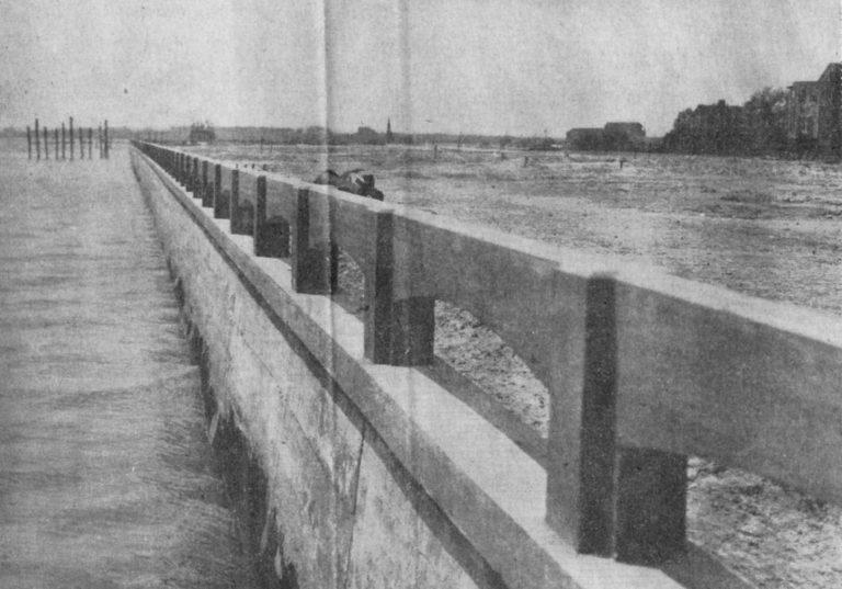
The elevated highway left difficult crossings, dead-end streets, heavy shade, noise, drainage problems, and land that felt more residual than public. Charleston tested an earlier response in 1976 with I-26 Linear Park. The City and Friends of the Lowline later purchased the former rail right-of-way in 2017, City Council approved the conceptual master plan in 2020, and the first phase broke ground in 2025.


1827–1830
The railroad company is chartered and the Best Friend begins service.
1957–1969
I-26 is constructed through the peninsula.
1976
Charleston creates I-26 Linear Park beneath the highway.
2004–2017
Rail service ends; the City and Friends purchase the right-of-way.
2020
City Council approves the conceptual master plan.
2025
Construction funding is approved and the first phase breaks ground.
The Vision
How to read these: the images come from the conceptual master plan. Final alignments, planting, materials, amenities, and programming may differ as the project is designed and built.
Use the sliders in each image to compare the existing condition with the conceptual rendering.
Bikeway and Path


Lowline Park


The Columns


A Corridor Worth Watching
The Lowcountry Lowline is no longer merely a good Charleston idea waiting in the wings. It is now a construction project with consequences for mobility, redevelopment, public space, and nearby homes.
Its success will not be measured by whether the renderings were attractive. It will be measured by whether people can reach the corridor easily, cross streets safely, move without constant conflict, and use the Lowline as part of an ordinary day.