Opens in a new tab

Charleston Livability Field Guide

Flood Insurance in Charleston

How flood zones, elevation, and insurance costs shape the decision to buy a home in Charleston.
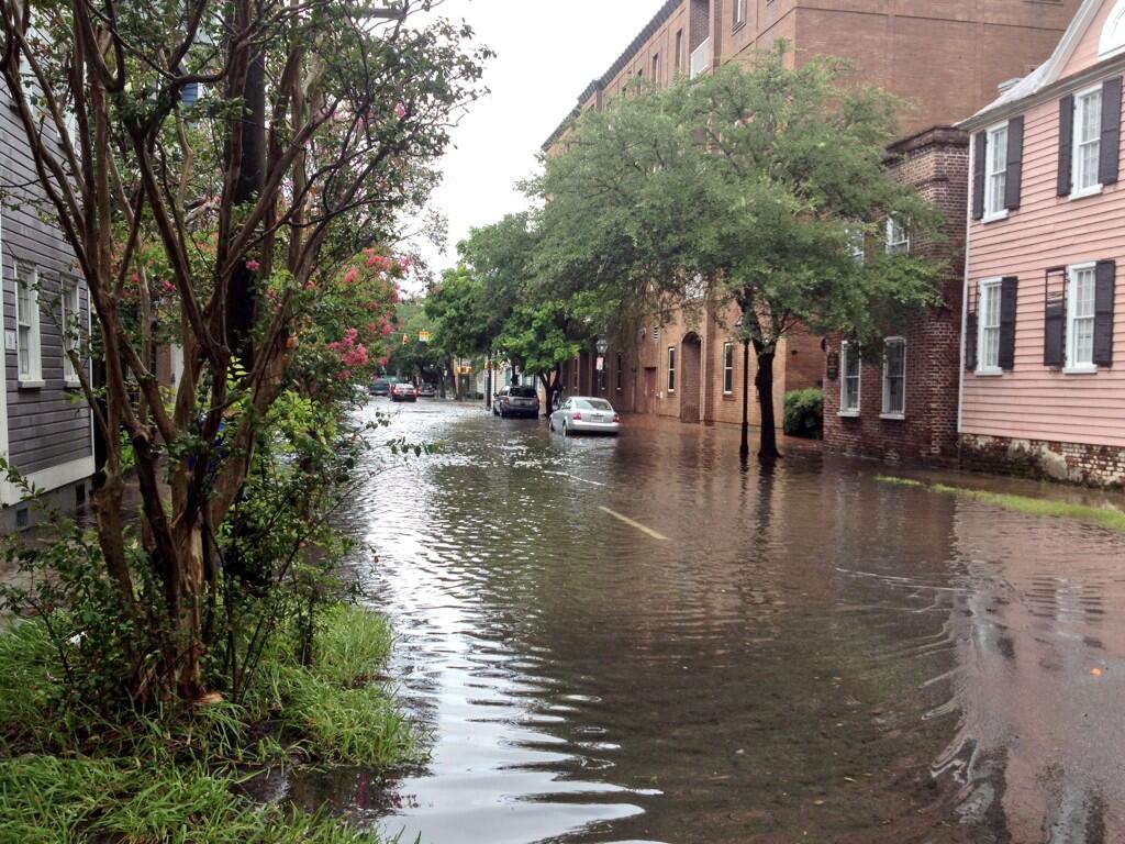
Street flooding in downtown Charleston

Owning property in the South Carolina Lowcountry means having a conversation about stormwater. Charleston is coastal, low-lying, and built around rivers, creeks, marshes, and drainage systems that are often deluged by subtropical weather systems.

That conversation is often misunderstood, occasionally overblown, and sometimes dismissed when it shouldn't be. I consider flood risk and insurance for every property my clients evaluate – not because every home floods, but because every property deserves a fresh round of due diligence.

Street flooding in downtown Charleston.

01 / Mapped hazard

Map & Risk

Flood maps are used to establish the flood hazards in a particular area, but they are only part of the picture. They do not tell me how a particular house, lot, street, or drainage system will actually behave. What matters is how that risk pattern on the map is applied to the property itself.

What the Map Tells Us

The FEMA map tells us which mapped flood hazard applies to a property and whether it falls inside the Special Flood Hazard Area. That matters for regulation, and for mortgages – you can expect that a lender will be checking the flood zone situation of a property under contract, and may require a flood insurance policy to be in place at closing.

Zone X

Outside the Special Flood Hazard Area

Unshaded Zone X represents minimal mapped flood hazard, while shaded Zone X represents moderate mapped flood hazard. These areas sit outside the Special Flood Hazard Area, but that does not mean flood risk is zero.

Zone AE

Special Flood Hazard Area with a mapped BFE

Zone AE is common around Charleston. It identifies a higher mapped flood hazard within the Special Flood Hazard Area and includes a Base Flood Elevation used for floodplain regulation and building requirements.

Zone VE

Coastal flood hazard with wave action

Zone VE identifies a Coastal High Hazard Area where storm surge and wave action create greater structural exposure. It includes a mapped Base Flood Elevation like Zone AE, and generally means stricter construction standards – often requiring elevated structures on pilings with open foundations.

Example FEMA flood zone map for a Charleston area coastal property, labeled with zones X, AE10, AE11, and VE12.

Flood zone maps establish mapped hazard and regulatory context. They are an important starting point, but they do not describe every way water can affect an individual Charleston property.

Reading the map

The map is useful for establishing the property's FEMA flood zone designation, whether it lies within the Special Flood Hazard Area, and the mapped Base Flood Elevation for AE and VE zones.

For an individual property, we can use the current official maps from FEMA:

Official Flood Map Link

Updated Flood Zone Maps: Charleston County’s current flood maps took effect in 2021 – I wrote about that transition at the time, including why some properties changed zones while many did not. Read the 2021 flood-zone update

Beyond the Map

A flood zone designation is useful, but it does not explain every way that water may affect a property. It will not tell us much about a low spot in the street, a poorly graded lot, a clogged drainage path, or the way a high tide may hamper the drainage rate of a neighborhood.

That is why we still look closely at the physical setting around a house – street elevation, nearby creeks or marsh, the apparent direction of drainage, the condition of stormwater infrastructure, and the way neighboring lots shed water – they can all help us understand how a property may perform under pressure.

Those observations are only a starting point, often made during the first showing. Once a property becomes a serious candidate, that is when we bring in the professionals – surveyors, insurance agents, and perhaps even engineers – during our due diligence.
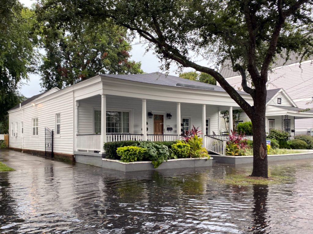
A home in Charleston with street flooding

Localized drainage, tide, and street elevation can affect the way water behaves around a property even when the FEMA designation itself has not changed.

02 / Reading the building

Elevation & Structure

Once the mapped context is clear, I move from the map to the house itself. Two properties in the same flood zone can present very different questions because their occupied floors, foundations, lower enclosures, and mechanical equipment may sit at very different elevations.

Base Flood Elevation is an important reference, but it is only part of the picture. What matters in practice is how the actual building relates to that elevation: where the first occupied floor begins, what sits below it, how the foundation is configured, and where vulnerable equipment is located.

Freeboard

Local floodplain rules may add freeboard – an additional margin above Base Flood Elevation. That additional elevation can apply to new construction and substantial improvements, and the amount and how it applies can vary by jurisdiction and project type. This is something I verify with the local building office rather than make assumptions from the map alone.

Reading elevation

The house has its own vertical story
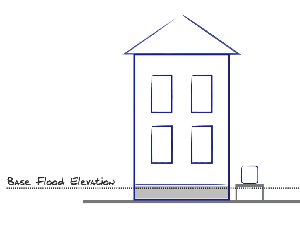
The useful comparison is not simply whether a property is in Zone AE or VE. It is where the occupied floor, foundation, enclosure, and equipment sit in relation to the mapped flood elevation.

Simple line diagram of a house with four windows and simple foundation, with a line labeled “Base Flood Elevation” slightly above the bottom line.

Elevation Certificates

Useful documentation, when it exists
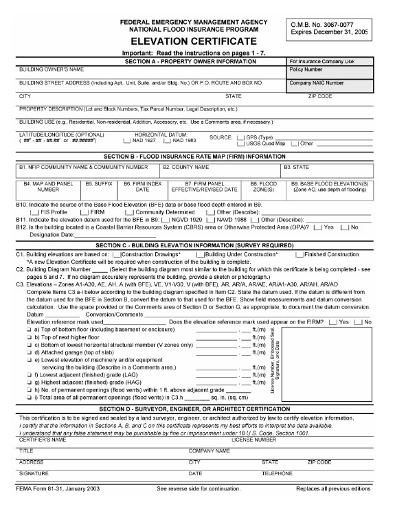
An Elevation Certificate documents key elevations and building characteristics for a property. It can help clarify how the structure relates to the mapped flood elevation, and in some cases better elevation information may also help refine an insurance quote.

FEMA Elevation Certificate for a Charleston-area property.

A current Elevation Certificate can document the building's flood zone, Base Flood Elevation, key floor elevations, foundation configuration, and other characteristics used to understand the property.

01

Does an Elevation Certificate already exist for the property?

02

What does it tell us about the occupied floor, foundation, enclosure, and equipment?

03

Would better elevation information change the way the property is evaluated or quoted?

Older Homes, Newer Standards

Charleston's housing stock spans centuries, and flood-related construction standards have changed substantially over time. A historic house that has occupied the same site for generations and a newer elevated home may sit in the same mapped zone while presenting very different questions about floors, foundations, enclosures, utilities, and future work.
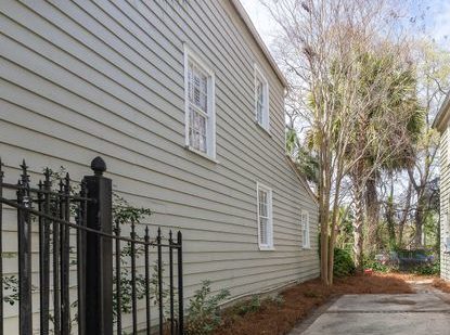
Back side of a Charleston Single House

Older Construction

Existing conditions matter
With an older house, I am often trying to understand what is already there: the floor elevation, crawlspace or foundation, additions, utility placement, drainage around the structure, and any history of repairs or water intrusion. Age alone does not establish flood performance.

Newer Elevated Construction

Designed around newer rules

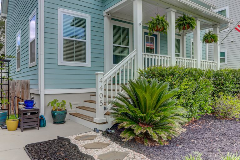
Newer construction in mapped flood-hazard areas is more likely to reflect modern elevation, foundation, enclosure, and equipment requirements. That can make the building easier to interpret, but newer construction is not automatically lower-risk or less expensive to insure.

The distinction is not old versus new, but rather how the structure was built, altered, elevated, and maintained – and whether those conditions make sense for the property's mapped and physical setting.

The construction history also matters when a buyer plans major renovations, because substantial work can trigger current floodplain requirements that did not apply when the house was originally built.

Property Improvements

Planning a Major Renovation?

A house may have been built under very different floodplain rules than the ones that apply today. If a renovation or repair becomes a “substantial improvement,” current floodplain requirements can become part of the project.

The federal baseline is generally reached when the cost of improvements equals or exceeds 50% of the building's market value, excluding the land. Local governments can apply cumulative rules and higher standards, so the relevant jurisdiction matters.

The cumulative period is not the same everywhere in the Charleston area. The City of Charleston currently looks back one year; Charleston County uses a five-year period in the jurisdictions for which it provides building-inspection services. Other municipalities may apply their own standards.

For a buyer considering a large renovation, I want this question on the table before plans and budgets harden. The right next step is usually to verify the property with the local floodplain or building office rather than assume the existing house can simply be remodeled in place.

City of Charleston floodplain development guidance

Once I understand the map and the building, the next question is financial: what does it actually cost to insure this particular property, and what coverage are we buying?

03 / Coverage & cost

Insurance & Pricing

Flood insurance and homeowners insurance can both involve water damage, but they are not interchangeable. The cause of the water matters. A plumbing failure, roof leak, or wind-related opening is a different insurance problem from floodwater rising across normally dry land.

For a buyer, I am less interested in memorizing every coverage definition than in identifying which policy is expected to respond, what is actually covered, and whether a meaningful gap exists. The policy language and the specific cause of loss ultimately control.

The cause matters

Most homeowners policies exclude flooding as that term is defined by the policy, while flood insurance is written for qualifying flood losses. Similar-looking water damage can therefore fall under very different coverage depending on what actually happened.

Coverage boundary

What kind of water are we talking about?

The presence of water is not enough to tell us which policy applies. I want to know where it came from, how it entered the building, whether wind or another event contributed, and how the policies define the loss.

Homeowners / Wind

Plumbing failures, roof or window openings, and wind-driven rain generally begin with the homeowners or wind policy rather than flood insurance. The cause of the damage and the actual policy language determine where coverage begins.

Flood

Flooding across normally dry land

Street flooding, rising stormwater, tidal water, creek or river overflow, and storm surge are where the flood policy question begins. Similar looking water damage can fall under very different coverage depending on how the water reached the house.

For a buyer, the practical point is straightforward: flood coverage should be reviewed alongside the homeowners and wind policies, not assumed to be buried somewhere inside them. I want the boundaries between those policies understood before the property is underwritten—or the water arrives.

The Map and the Premium Answer Different Questions

Flood-zone maps remain important for hazard mapping, floodplain regulation, and determining when certain insurance requirements apply. They are no longer a shortcut for estimating what a particular NFIP policy should cost.

Under FEMA's Risk Rating 2.0 methodology, the NFIP looks more closely at the individual property: where it sits, how it is built, how high the first floor is, what it would cost to rebuild, and what coverage the owner chooses. Two houses carrying the same flood-zone designation can therefore produce very different premiums.

Flood Map

What mapped hazard applies here?

The map establishes flood zone designation, Special Flood Hazard Area status, mapped Base Flood Elevation where applicable, and other regulatory context.

≠not the same question

NFIP Premium

What does this individual property cost to insure?

The premium reflects a broader set of location, building, mitigation, replacement cost, coverage, and deductible variables specific to the insured property and policy.

What changes the price

The premium can reflect the property's location and proximity to flood sources, first floor height, foundation and equipment elevations, replacement cost, and the coverage and deductible selected. Those variables are why two houses carrying the same flood zone designation can produce very different insurance prices.

That is why I am hesitant to ballpark a flood premium from the zone label – once a property becomes a serious candidate, I want an actual quote that's specific to the actual house.

An Elevation Certificate is no longer required to obtain an NFIP quote in many cases because FEMA can derive first-floor-height information from other data. A policyholder can still provide one when better elevation data may produce a more favorable result.

Policy options

NFIP and Private Flood Insurance

The NFIP remains an important part of the Charleston flood-insurance market, but it is not the only place a buyer may obtain coverage. For many properties I want to see both the NFIP option and any credible private-market alternatives before treating the insurance cost as settled.

Private flood insurance is no longer limited to unusual coastal properties. Depending on the house and insurer, a private policy may offer different pricing, limits, deductibles, underwriting, or coverage terms. That does not make it automatically better; it makes it another real option to compare.

National Flood Insurance Program

NFIP

A standardized federal program with familiar eligibility and policy rules. It can provide a useful reference quote, particularly where a lender or prior policy history already points toward NFIP coverage.

Private Flood Insurance

Private Market

Private carriers may price the same property differently or offer different limits, deductibles, covered property, and underwriting terms. Availability and lender acceptance still need to be verified for the actual transaction.

They are not automatically better, though they are another real option to compare.

When I Compare Quotes

When I compare flood quotes, I am looking at the differences that will matter to the owner: coverage limits, deductibles, what property is covered, exclusions, effective dates and renewal terms, and whether the lender will accept the policy.

For a typical one- to four-family residential building, NFIP coverage is generally limited to $250,000 for the building and $100,000 for contents. A more expensive Charleston property may therefore require a closer look at whether those limits match the actual exposure.

An existing NFIP policy may sometimes be assignable to a buyer, subject to program requirements. I treat that as something to verify with the insurer rather than assume from the listing or prior owner's paperwork.

Once the coverage and pricing are real numbers instead of assumptions, they can finally be put back where they belong: inside the decision about the property itself.

04 / Property evaluation

Due Diligence

Flood questions belong inside the property evaluation process, not at the end of underwriting and certainly not after closing. I want the important facts early enough to influence the offer, the due diligence period, the financing, and the buyer's expectations about long-term ownership.

My role is not to pronounce a property safe or unsafe from a flood map. It is to build a useful property file, identify what still needs verification, obtain realistic insurance information, and put those facts back into the larger decision about the house.
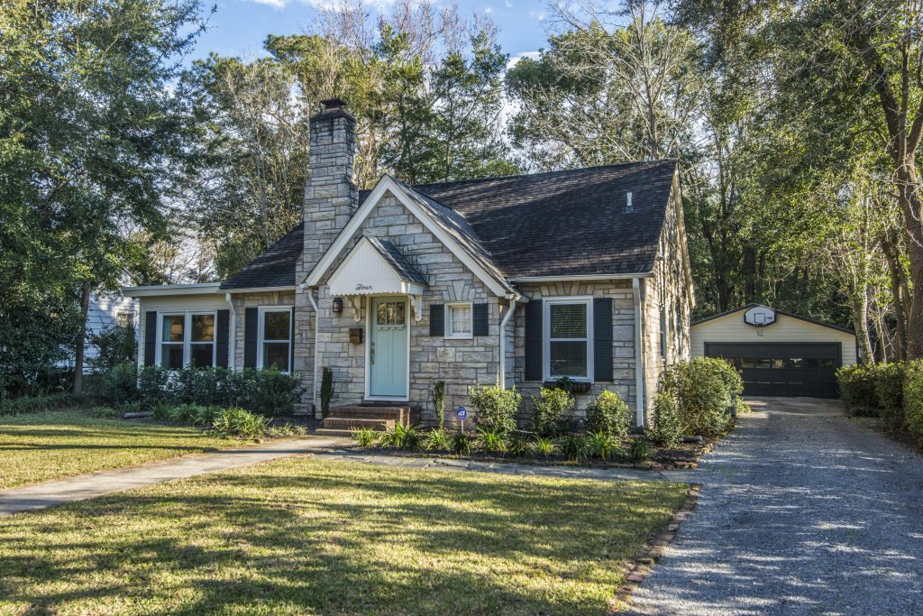
A midcentury home in the Charleston community of West Ashley
Due diligence starts with the property itself – how the house meets the ground, where water appears able to move, and which observations deserve verification once the documents and professionals become involved.

01

Before an offer

Screen early

I start with the flood zone designation, nearby water, the apparent site elevation, and anything obvious about drainage or the way the house sits on the lot. The goal is not a complete answer; it is to identify questions that could matter before an offer is written.

02

Property file

Build the file

Then I gather what the property can actually tell us: surveys, Elevation Certificates when available, seller-provided information, permits, inspection findings, repair history, and anything else that helps explain the structure and site. Missing information is part of the file too.

03

Insurance

Price the policy

Once the property is a serious candidate, I want a real flood quote based on the actual house – not an estimate inferred from the zone. When financing is involved, the coverage also needs to satisfy the lender without creating a surprise late in underwriting.

04

Property decision

Put it back into the property decision

The premium, deductibles, remaining uncertainty, and physical exposure become part of the same comparison as condition, renovation needs, taxes, location, and price. Flood risk is one ownership cost and one property characteristic – not a separate verdict handed down by the map.

Condominiums

Buying a condo?

In a condominium, the flood insurance question extends beyond the individual unit. The association may carry coverage for the building, but I still want to understand what that policy covers, its limits and deductibles, and what exposure remains with the unit owner.

Association coverage

What flood coverage does the association carry, and what are the applicable limits and deductibles?

Unit-owner Exposure

What property, interior improvements, personal belongings, deductibles, or assessment exposure remains with the individual owner?

One does not need to become a floodplain hydrologist in order to feel confident buying a home in Charleston. We just get the relevant facts early enough to matter, understand what still needs verification, and decide whether the property makes sense with those facts included.

Property buying guidance

Evaluating a property?

If a Charleston-area property has a flood zone designation, elevation question, unusual construction, or insurance quote that deserves a closer look, I can help put those pieces into the larger property decision.